TOTAL PAGEPREVIEW

HISTATS

Wednesday, August 1, 2012

Gosaikunda

Gosaikunda is an alpine freshwater oligotrophic lake in Nepal's Langtang National Park, located at an altitude of 4,380 m (14,370 ft) above sea level in the Rasuwa District with a surface of 13.8 ha (34 acres). Together with associated lakes, the Gosaikunda Lake complex is 1,030 ha (4.0 sq mi) in size and has been designated a Ramsar site in September 2007.
The lake melts and sips down to form the Trishuli river and remains frozen for six months in winter October to June. There are 108 lakes in this area, small to medium in size. The challenging Lauribina La pass at an altitude of 4,610 m (15,120 ft) is on its outskirts.

Trekking to Gosaikunda

The popular start to the trek to Gosaikunda are in Dhunche Village or Syabru Besi both from the Langtang side. Alternatively, trekkers may also start from Sundarijal, which lies on the outskirts of Kathmandu.
If you are starting from Dhunche, the first day involves a long steady climb to reach Chandan Bari, which is at a height of about 3200 meters. On the second day, one reaches Laurebinayak at about 3700 metres. At this point, some trekkers choose to climb ahead to Gosaikund, though altitude sickness is a concern due to rapid ascent. Many trekkers choose to stay at Laurebinayak which also provides excellent sunset and sunrise views of the Langtang and Ganesh Himal. 
The descent from Gosaikund to Sundarijal takes about four days. The first day involves a short climb to Laurebina pass (4600 metres) and a rapid descent to Phedi or Teashop. Depending on pace, there are options to stay at Tharepati, Mangengoth, Kutumsang and afterwards at many village habitations every two hours. Accommodation is quite easily available, though basic and a variety of food options are also available at tea house stops.
The trails are very well marked, except between Ghopte and Thorepati, where chances of losing ones way are real.

Halesi Mahadev

Among the most ancient and holiest places of Nepal, it is very popular as The Pashupatinath of the eastern Nepal. It is situated at the hilly region of the country in between the holy rivers Dudh Koshi to the right and Sunkoshi to the left. The temple is situated at the top of a small hill inside a beautiful cave. There lie other numerous small beautiful caves too. Importance. Here, the image of the god is inside the cave, which is full of natural beauty. Inside the cave is dark and there are bats flying here and there. It is also a kind of pride for the people living there, as it is as famous as other temples like the Pashupatinath, the Lumbini etc. even internationally. It is the natural cave, which lies in 4th remote hilly region and is believed to be in existence since 6000 years. It is the place full of natural beauty and cultural inheritance. It is popular among the Hindus as well as the Buddhists all over the world.

Mythology

There are three mysterious caves, which are believed to be the three eyes of lord Shiva. as we see in the first cave, we see an image of lord Shiva which is called as Haleshwar Mahadev. In the second cave there is an image of Nandi.
Haleshi temple is situated in the Khotang district of eastern Nepal . This is a small hilly area full of natural beauty. The location of the place itself is beautiful. One the other hand, the beautiful and mysterious natural caves; full of different natural images, look as if the stone carving artist have donelt carefully taking a lot of time. Here, the images are all inside the caves which themselves are mysterious.

Worship & Festivals

Lord Vishnu was the first ever devotee to pay homage to the Haleshi Mahadeva in the Satya Yuga, the golden age where as Balaram did in the third age called Dwapar Yuga. Afterwards, many kings, sages, devotees, philosophers, thinkers, hermits, abbots, ascetics and shankaracharya have been paying homage to this sacred place.
 
During the homage hours, kettledrum, cymbal, clarinet etc, there is a custom of performing special ceremonial rites of the Haleshor Mahadeva during some festivals such as Bala Chaturdashi, Shiva Ratri, Ram Nawami and Teez etc. In between, devotees perform various other religious performances like fire sacrifice and recitals of the Rudri, the Chandi and the Vedas, our religious epics, burning of 10 millions holy threads and offering millions of wood apple leaves etc. The Haleshwor Mahadeva is taken as the god of fulfilling wishes and giving boons to the real devotees. So devotees vow solemnly and act accordingly as their wishes has been fulfilled.We believe this is only the place for the people all over the world to visit once in a life time and watch the beautiful, mysterious amazing and purely religious place where the people are traditionally rich in their culture. It is really a matter of pride to all of us.

How to go There

Halesi Mahadev Temple is lies in the Khotang district eastern part of Nepal . There is flight service from Kathmandu to Lamidanda but th flight service are not regular, about 3 times a week to Lamidanda, After Lamidanda there is trekking route to Halesi Mahadev temple, it takes time  5-6 hrs. by walk. There is Helipad near by Halesi mahadev temple, as same day we can visit Halesi Mahadev temple by private Helicopter, It takes time 2 hrs from Kathamandu to Halesi to Kathmandu.
 
And there is regular bus service from Kathmandu to Kotari,There is unpaved way from Kotari to Ghurmi, where we can go by jeep or local rented vehicle, After Ghurmi to Halesi there is not road,

Monday, July 30, 2012

Shivapuri Nagarjun National Park

Shivapuri Nagarjun National Park is the ninth national park in Nepal and was established in 2002. It is located in the country's mid-hills on the northern fringe of the Kathmandu Valley and named after Shivapuri Peak of 2,732 m (8,963 ft) altitude. It covers an area of 159 km2 (61 sq mi) in the districts of Kathmandu, Nuwakot and Sindhupalchowk, adjoining 23 Village Development Committees.

History

The area has always been an important water catchment area, supplying the Kathmandu Valley daily with several hundred thousands cubic liter of water. In 1976, the area was established as a protected watershed and wildlife reserve. In 2002, it was gazetted as Shivapuri National Park, initially covering 144 km2 (56 sq mi), and extended by the Nagarjun Forest Reserve in early 2009 to its present size.

Makalu Barun National Park

The park and conservation area is situated in the Sankhuwasabha and Solukhumbu districts, bordered by the Arun River on the east, Sagarmatha (Mt. Everest) National Park on the west, the Nepal-Tibet border on the north and Saune Danda (ridge) to the south. The Park covers 2,330 sq. km.This is the only protected area in Nepal with designation of a Strict Nature Reserve. It has some of the richest and most unique pockets of plants and animals in Nepal, elsewhere lost to spreading human habitation. Stepping up the slopes are a series of vegetation zones starting with tropical sal forest below 1,000 m. elevation: subtropical schimawalchhi forest at 1,000-2000 m. fir, birch, rhododendron forests in the sub-alpine (3,000-4,000 m); and herbs, grasses and rhododendron/juniper shrubs in the alpine pas trues (4,000-5,000 m). 
 
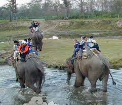
There are 47 varieties of orchids, 67 species of bamboos, and 15 oaks including Arkhoulo, 86 species of fodder trees and 48 species of primrose. Over 400 species of birds have been sighted in the Makalu-Barun area, including two species never before seen in Nepal the spotted wrenbabbler and the olive ground warbler. Wildlife includes the endangered red panda, musk deer, Himalayan black bear, clouded leopard and possibly snow leopard, in addition to more substantial populations of ghoral, thar, wild boar, barking deer, Himalayan marmot and weasel, common langur monkey and the serow. The Arun river system contains 84 varieties of fish.

Entry Fee:
  • For Nepalese Nationals, Free
  • For SAARC Nationals, Rs. 100/- per person
  • For Other Foreign Nationals, Rs. 1,000/- per person

Access:
  
To reach Makalu-Barun National Park & Conservation Area, take the daily flight from Kathmandu to Lukla, Phaplu, Lamidanda, Bhojpur and Tumlingtar. Visitors choice to fly any one-air link airports then trek or drive by private vehicle or public bus to Dhankuta Hile.

Twitter Delicious Facebook Digg Stumbleupon Favorites More

 
Design by Free WordPress Themes | Bloggerized by Lasantha - Premium Blogger Themes | Powerade Coupons